
SFMTA Staffers Share their Favorite SF Bike Rides

SFMTA Staffers Share their Favorite SF Bike Rides
By Eillie Anzilotti

Happy Bike Month, San Francisco! To celebrate, we’re sharing some of SFMTA staffers’ favorite rides through the city. From protected bike lanes to quick-build projects to Slow Streets, the JFK Promenade, and the Great Highway, all of the routes roll through projects that the SFMTA has completed in the last several years to make biking through San Francisco easier, safer, and joyful. We hope you get some inspiration for your next ride--and share your favorite route with us! For easy trip planning, we’ve included each ride below on an interactive map.  

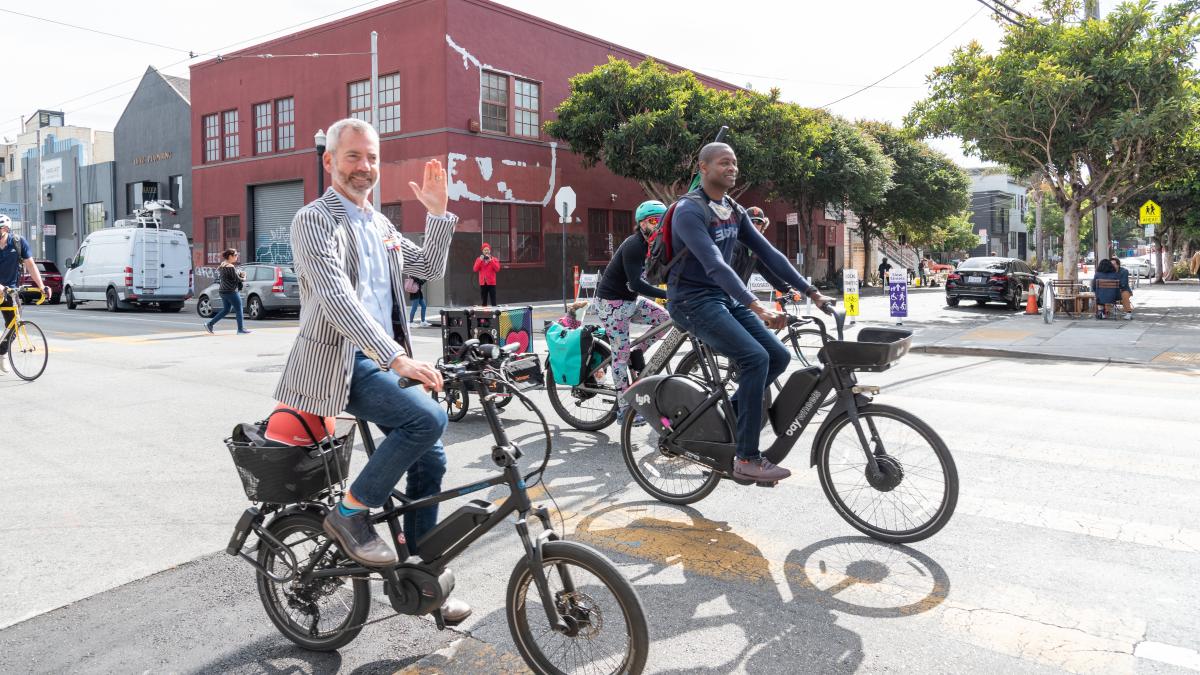
Jeffrey Tumlin, Director of Transportation: “I explore all of San Francisco by bike, but this is a standard trip: Starting from the Castro, I head up the Slow Street on Noe, where I like to admire the trees and people watch in Duboce Park. Then, I ride north on Scott to Fell Street along the Panhandle. When I reach the new JFK Promenade, it’s amazing how the feeling changes. You can hear birdsong everywhere, and I can’t count the number of kids whom I’ve seen learning to ride a bike, scooter, or skateboard. Then, I ride the whole length of the park to the Great Highway. I’ve lived in San Francisco my whole adult life, but thanks to the JFK Promenade I’ve been to the beach more times in the last two years than the previous 30. I love seeing the community out along the Great Walkway, and exploring the restaurants in the Outer Sunset and Parkside neighborhoods for a picnic. I grab a coffee at Andytown or the Kahve truck, then make my way back using Page Slow Street, stopping to pick up fresh flowers from Guy Clark, whose owned his shop on 15th and Noe for almost 40 years.” 

Jeffrey Tumlin riding his bike on San Francisco streets smiling and waving.

Soroush Roback, Engineer, Livable Streets; Kimberly Leung, Acting Pedestrian Program Manager, Livable Streets; Victoria Chong, Planner, Livable Streets; Winnie Lee, Engineer, Livable Streets: “We’ve done this ride as a group a few times since COVID began: We start in the Marina, ride through the Presidio the Inner Richmond, then take the Cabrillo Slow Street down into Golden Gate Park, then out to the ocean. The route spans Lake Slow Street, the JFK Promenade and car-free MLK, the Great Walkway, and the Arguello Bike Lanes, with a beer stop at Beach Chalet Fields. From end to end, it‘s a leisurely, safe 18 miles with great scenery and people watching!”  

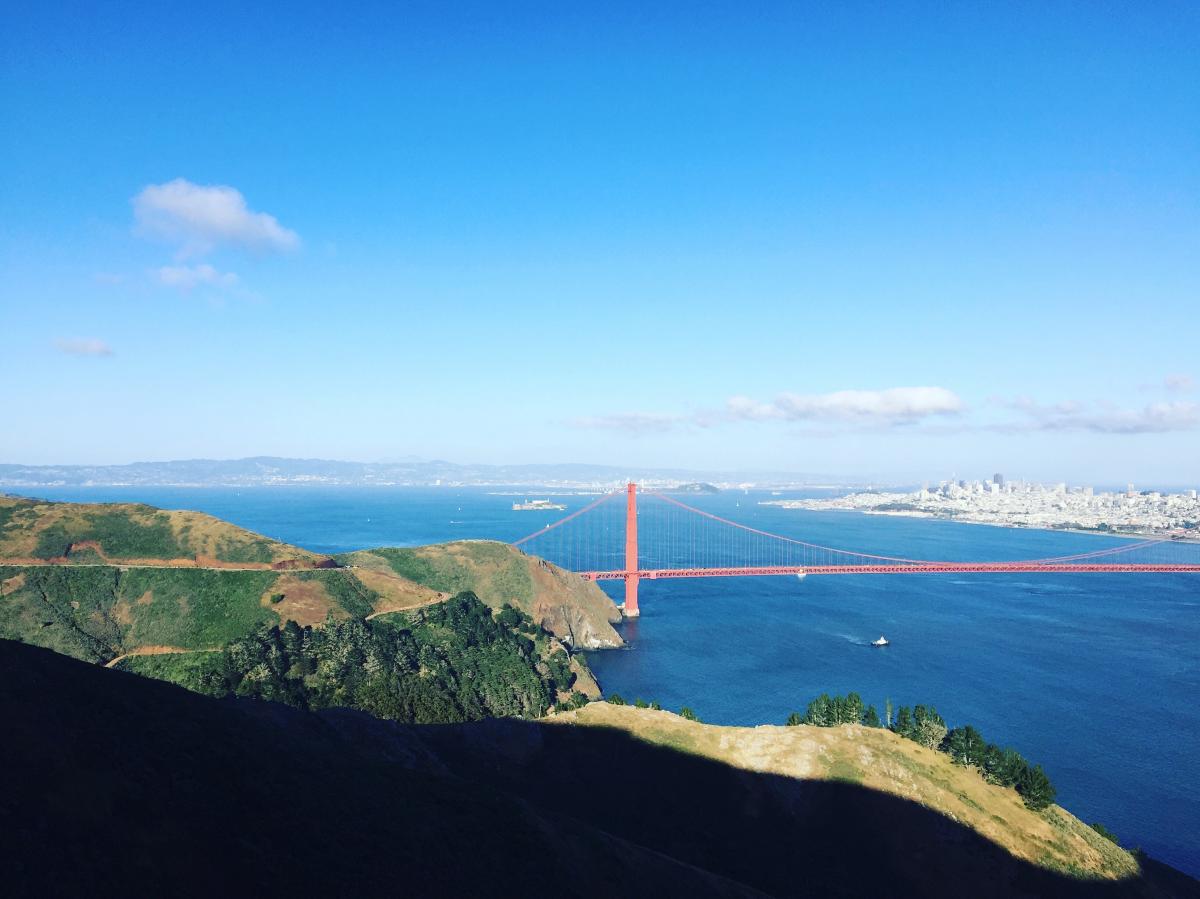
Mari Hunter, Planner, Parking & Curb Management: “I live in southern Marin so I ride back and forth over the Golden Gate Bridge.  On the way in, I drop down to the bike path past Crissy Field then roll over Pac Heights and through Japantown using the bike route on Steiner to the Slow Street on Page, which I take down to Market. On the way back, I boogie over to the Webster bike lanes then wiggle up to the Slow Street on Clay, head west to Arguello and go through the Presidio to the bridge.  I love the variation: some good hills, gradual climbs, sharrows, bike lanes, and Slow Streets—plus great views!” 

View from southern Marin overlooking the Golden Gate Bridge and San Francisco skyline

Kimberly Leung, Acting Ped Program Manager, Livable Streets: “I bike from the Richmond neighborhood to the SFMTA office on South Van Ness taking Cabrillo Slow Street to 8th Ave to car-free JFK to the Page Slow Street to Market! I only started bike commuting in December 2019, and when the pandemic hit, car-free and car-light streets were a game changer for me by giving me the space to practice being more comfortable on a bike. Biking is now my primary way of getting around the city, and I’m so happy that so many other people can experience that on streets that are so much more inviting for people to walk and bike now.”  

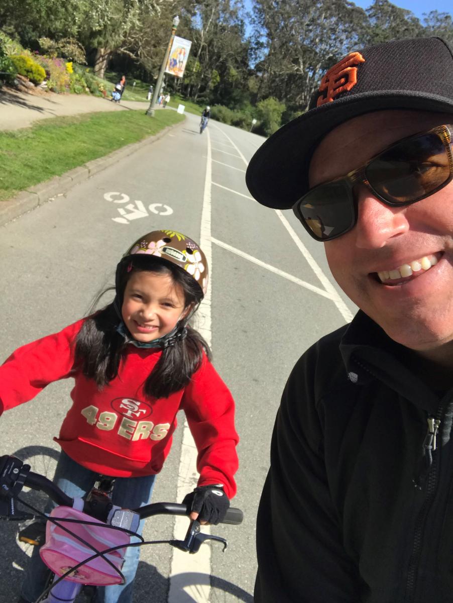
Mike Sallaberry, Senior Engineer, Livable Streets: “My nine-year-old daughter and I take this route to get ice cream! Starting at Cabrillo Slow Street, we take the 23rd Ave Slow Street north to Lake Slow Street, go along Lake to 5th Avenue, then take 5th Avenue south to get ice cream at Toy Boat on Clement. After we fuel up, we take 5th Avenue to Golden Gate Park, enter in at 6th Avenue, and then take JFK Drive west to Transverse, get on the dirt path along Crossover and take that back to Cabrillo. It’s very safe— almost all either a Slow Street, car-free JFK, or a path (short sidewalk segments too)—and the ice cream stop halfway is perfect to relax a bit and get sugared up for the return trip home.” 

Mike Sallaberry and his daughter smiling on their bikes in Golden Gate Park

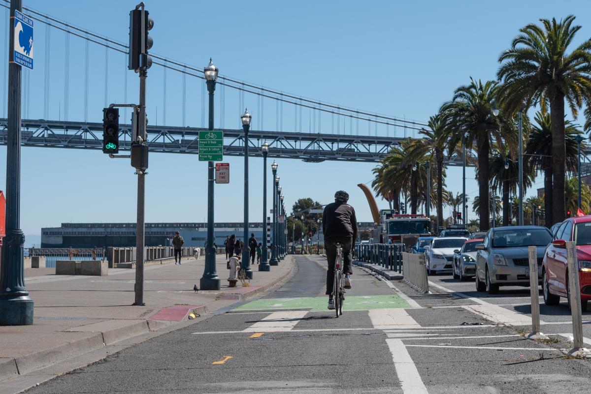
Jen Wong, Planner, Livable Streets: “I like to ride from the Ferry Building down the Embarcadero, then switch to the off-street San Francisco Bay Trail at Oracle Park, hugging McCovey Cove. From there, I take the 3rd Street Bridge and follow the waterfront past the Chase Center and end at Crane Cove Park or head all the way down Minnesota Slow Street into the Dogpatch. I love the views and how safe it is, with car-free portions and protected bike lanes—and the fun places to eat and drink at along the way, like The Ramp and Spark Social.” 

The view while riding on the Embarcadero looking at the Bay Bridge waterfront view

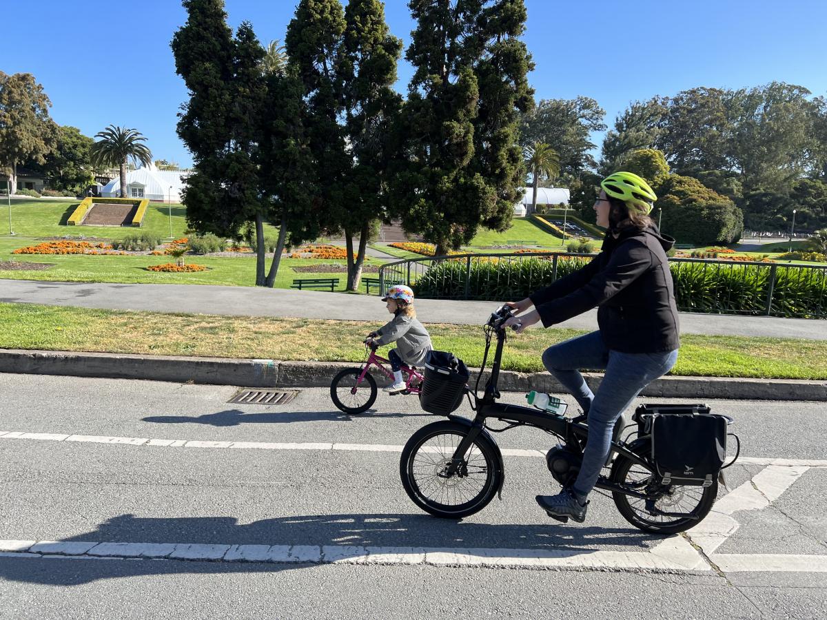
Laura Stonehill, Engineer, Livable Streets: “We like to take weekly weekend rides as a family, and around a third of them go from our home in the Mission to Golden Gate Park so my five-year-old can ride on the car-free streets. My husband and I both have e-bikes, and we take a route that’s a bit steeper but more low-stress and car-light: We ride from 17th Street to Valencia, then take Octavia to the Slow Street on Page, all the way into Golden Gate Park. Once we reach car-free JFK, my five-year-old gets on her own bike and we ride to any park destination she wants—recently, we went all the way to the Boat Playground at 45th Avenue using the car-free route. On the way back, we like to stop at the Panhandle Playground before taking the Wiggle back to the Mission.” 

Laura Stonehill and family riding in Golden Gate Park

Eillie Anzilotti, Public Relations Officer, Livable Streets: My favorite ride crosses the whole city: I start at the Ferry Building and take Better Market Street to the Wiggle. In my childhood memories, Market Street is jam-packed with traffic, and I love how safe it is for biking now. Mid-Wiggle, I stop for a coffee at Café Reveille, slide my to-go coffee into my water bottle cage and keep pedaling! From there, I ride along the Panhandle in the Fell Street protected bike lane—it was installed as a social distancing response during COVID, and I find it to be super useful when the Panhandle path gets crowded. Then it’s on to the car-free route through Golden Gate Park and out to the Great Highway for some ocean views! Unless I take a longer coffee break, the whole ride takes me less than an hour—and it’s safe, (mostly) flat, and beyond pleasant.”   


Published May 13, 2022 at 11:32PM
https://ift.tt/Rk3V0e2

Comments

Popular posts from this blog

Powered Scooters Charge City’s Transportation Recovery

Powered Scooters Charge City’s Transportation Recovery By Jason Hyde The SFMTA is releasing its next round of Powered Scooter Share permits on July 1. Scooters remain a sustainable mode of travel and a complement to Muni and public transit service as the city recovers from the pandemic and San Franciscans begin to travel more. The SFMTA’s Powered Scooter Share Program is essential in ensuring that shared scooter operations support the city’s economic recovery in a safe, sustainable, and equitable way.  The SFMTA received four submittals for the permit program and will issue permits to two operators : Spin and Lime. Permits will be in effect for a one-year term, with the option to extend for another year at the discretion of the SFMTA based on compliance with various program metrics. While the new permit program does not set a limit on the number of scooters each operator may deploy, it does limit the overall citywide fleet size at 10,000. Starting at a base of 2,000 scooters...

What a Year It Has Been! Let the Celebration of Transit Month Continue

What a Year It Has Been! Let the Celebration of Transit Month Continue By Erin McMillan 49 Van Ness/Mission using the brand new bus rapid transit lanes on opening day in April. During Transit Month this September, we’re continuing the celebration by looking back to more of the work we’ve done over the last year— some that has been less obvious to Muni customers, but critical to a well-functioning system and other work that is more front and center. Fix It! Week and Continuing State of good Repair Work Muni is an impressive transit system. Moving thousands of people on rail and buses every day takes a lot of coordination and a lot of work. Dealing with unique challenges like San Francisco’s geography and shifting travel patterns, we also have to deal with issues related to the Muni system’s age. Proper care and maintenance of a transit system many decades old takes strategic planning as regular maintenance needs to happen while continuing to provide service. Typically, regular Mun...

Permanent Relief for Muni Customers in SoMa?

Permanent Relief for Muni Customers in SoMa? By Erin McMillan Shortly after the pandemic’s onset, the SFMTA implemented Temporary Emergency Transit Lanes to make sure essential trips on Muni wouldn’t get caught in traffic. On Mission Street from 11th to 3rd streets in SoMa , the transit lanes have proven effective at protecting Muni travel times while traffic has increased. Now, with the city’s reopening generating even more traffic, keeping these lanes on the road permanently is as important as ever. Paint Shop Crew Removing Old Pavement Markings for Installation of Transit Only Lanes on Mission Street on September 23, 2020 What’s Next? Given that the data shows the lanes are effective, the SFMTA is now pursing making the full-time transit lanes, and their benefits, permanent. Following up on our initial evaluation of the project, we are now inviting the community to learn about next steps for making the lanes permanent. We are hosting a two-week virtual open house where you ca...

Safer and Easier Parking in Every City-Owned Facility

Safer and Easier Parking in Every City-Owned Facility By Pamela Johnson Parking at any of our 22 city-owned facilities is now easier and safer than ever. Late last month we completed the Parking Access Revenue and Control Systems (PARCS) project. This four-year effort replaced aging parking equipment with modern technology and significant operational upgrades. Customer using new PARCS kiosk at North Beach parking garage Patrons will notice enhanced lighting, new wayfinding signs, audible alarms, cameras, gate arms, and payment machines with two-way digital intercoms . Behind the scenes is an all-new parking management system and 24/7 command center, connected to every machine. Can’t find your ticket to pay for parking?  No worries! Thanks to license plate recognition technology, cameras located at every facility’s entrance capture patrons’ plate numbers as they arrive . If a customer loses her ticket, the manager is able to re-issue a ticket based on her license plate...

Jason Roy chooses one between Rohit Sharma, David Warner as his opening partner https://ift.tt/3fkBiWu

Rohit Sharma and David Warner are two of the most destructive openers in the limited-overs format. The duo had been reigning the opening spot for their respective sides for years. Both the players continue to be the mainstays for their countries in all the three formats of the game. from IndiaTV: Google News Feed https://ift.tt/2ZjgDNe

SFMTA to Replace All Parking Meters in the City

SFMTA to Replace All Parking Meters in the City By Jessie Liang San Franciscans will see new parking meters on city streets beginning in early March 2022. Staff from the SFMTA’s Parking Meter Shop will replace the meters at all the nearly 27,000 paid parking spaces in the city because those meters have reached the end of their useful lives, and because many of the meters rely on 3G communications technology that soon will be phased out by the wireless companies. The first new meters will be installed in the South of Market and Mission Bay neighborhoods.  SFMTA staff will provide notices on vehicle windshields when the new meters are activated.  The new meters will provide several benefits, including larger and more legible screens, more intuitive user interface, more powerful batteries, and more resistance to vandalism.   The following neighborhoods will move to a pay-by-license-plate system with new paystations. South Beach SoMa Mission Bay Civic Center H...

Bob Planthold Tribute

Bob Planthold Tribute By Stephen Chun San Francisco lost a dedicated advocate for pedestrian safety and accessible public transportation with the recent passing of Bob Planthold. Having contracted polio at an early age, Bob used bright yellow Canadian crutches to help him move around. Firsthand experience of the obstacles people with disabilities may face in getting from place to place and accessing services made Bob a tenacious and persistent champion for pedestrian safety and accessible transit.   Bob’s activism contributed to real change that benefited people with disabilities in San Francisco. He was a member of the steering committee for the San Francisco Accessible Parking Policy Advisory Committee, which was established by the Mayor’s Office on Disability and SFMTA in 2012 to look into ways that SFMTA blue zone policy and the State Department of Motor Vehicles’ disabled placard policies could be improved to ensure greater availability of accessible parking in the Cit...

New Customer Information System Signs Coming to a Transit Shelter Near You!

New Customer Information System Signs Coming to a Transit Shelter Near You! By Kharima Mohamed As part of the Next Generation Customer Information System project, over 700 new Liquid Crystal Display (LCD) signs will display real-time information at Muni transit shelters. Approximately one-third of these signs will be double-sided to provide additional visibility at the highest-ridership stops and major transfer points. This week we installed a single-sided prototype at Eddy and Larkin streets. Serving the Tenderloin, an Equity Neighborhood , this sign will feature real-time predictions for the 19 Polk and 31 Balboa routes. The primary purpose for installing this prototype is to conduct in-field hardware testing, especially with rain, wind and colder temperatures.    We know there is an urgent need for more effective signage and are excited to roll out the new customer information system later this year.  The new LCD signs will eventually replace all existing Next...

Street Transformations to Address COVID-19 Keep San Francisco Moving

Street Transformations to Address COVID-19 Keep San Francisco Moving By Eillie Anzilotti A street closure in the Tenderloin as part of the COVID-19 response efforts. Since the start of the COVID-19 pandemic in March 2020, many aspects of people’s lives have changed – including how we get around town. To reflect this new reality, the SFMTA pivoted in the way we design and operate our streets. From streets that prioritized people walking and bicycling in some of San Francisco’s major parks to Temporary Transit Lanes (TETLs) that protected Muni lines from the return of traffic congestion, San Francisco reimagined how streets could be used for people. We have documented some of these transformations in a new report that highlights emergency street operations, Temporary Emergency Transit Lanes , the Slow Streets Program , Tenderloin street closures and reusing streets within or close to parks for recreational purposes. Within each effort, the report touches on the ways in which city ...

Agra: All historical monuments except Taj Mahal to reopen from September 1 https://ift.tt/2YnrJQd

The Agra district administration on Thursday announced that all historical monuments here, other than the Taj Mahal and the Agra Fort, will reopen from September 1. District Magistrate P.N. Singh said that the monuments -- Fatehpur Sikri, Sikandara, Etmauddaulabs tom, Ram Bagh, Mehtab Bagh and a few other smaller ones would be thrown open to public, but with a set of conditions.